On Walkability

So what’s with all the talk about walkability? Aren’t trails and such just fancy projects for tourists? What about the neighborhood issues we talk about over the kitchen table?

These are reasonable questions asked lately in reference to remixed renderings featuring scenes that ponder “What if?” Honesdale… looked like… this.

One way to answer them, in reverse order, might be: they’re connected; not really; it’s a part of everything and hasn’t gotten the attention it deserves.

Here’s a quick primer on how walkability connects to everyday life.

Walkability, therefore, is not a distraction or diversion of attention away from important Honesdale issues. It is integrally related. Recreational trails get flashy attention but being able to walk within our community represents a foundation of accessibility. One that supports the local economy and a high quality of life.

Our last major road network investments did not account for walking. Those were choices people made. Our next round of investments can add that value back for the current and for future generations.

Within our local landscape, everybody walks or wheels around depending on their abilities.

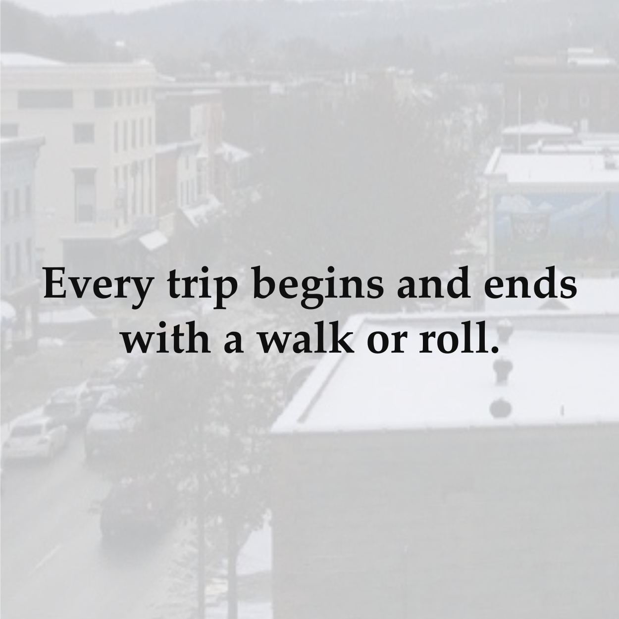
Yes; there is a lot of driving and it’s very noticeable. It is the preferential mode of transport our street networks have been designed around, after all. Each bit of driving, however, includes a walk or multiple walks that are so baked into our travel experiences they hide in plain sight.

We walk to our cars, across yards and into garages from home. We walk between our cars and destinations, through parking lots and along sidewalks. We walk inside our homes and places of work and anywhere else we inhabit on a daily basis. Even when we take the bus or hop a train or ride our bike, a walk is still part of the journey.

The same isn’t true for driving. For many of us, a drive is necessary. For others, it isn’t. Either way, a walk isn’t dependent on driving yet each drive depends on walking.

Crosswalk, West and Park Streets, Honesdale

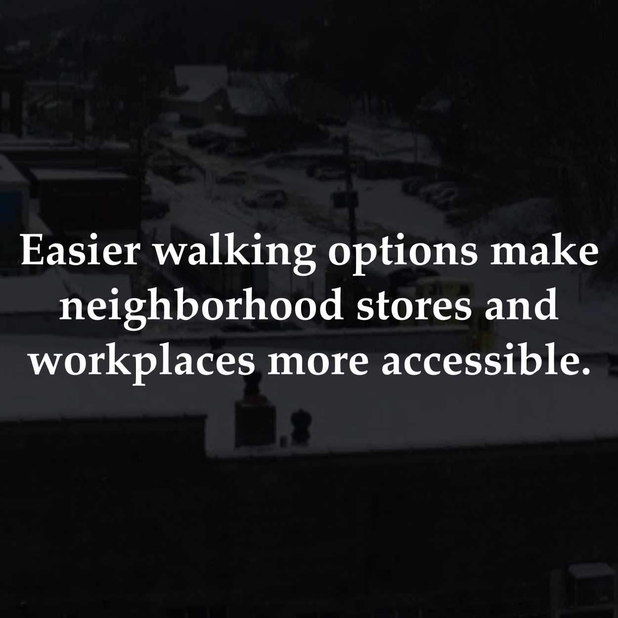
Walkers represent the least accommodated transportation user, network wide, even though that type of usage is ubiquitous and a part of every trip. Planning around these everyday strolls has been neglected. Some necessary walks are now uncomfortable and other reasonable walks are inconvenient. We can fix that by paying attention to how walkable our community is.

Recognizing the baseline of accessibility that compliments the most total users is at the heart of walkability. Being able to comfortably and conveniently walk around is critical because it reflects the core functionality of our transportation system. When we plan out and develop land uses within our local landscape, it’s important to address core functions, like those that accommodate the most number of people.

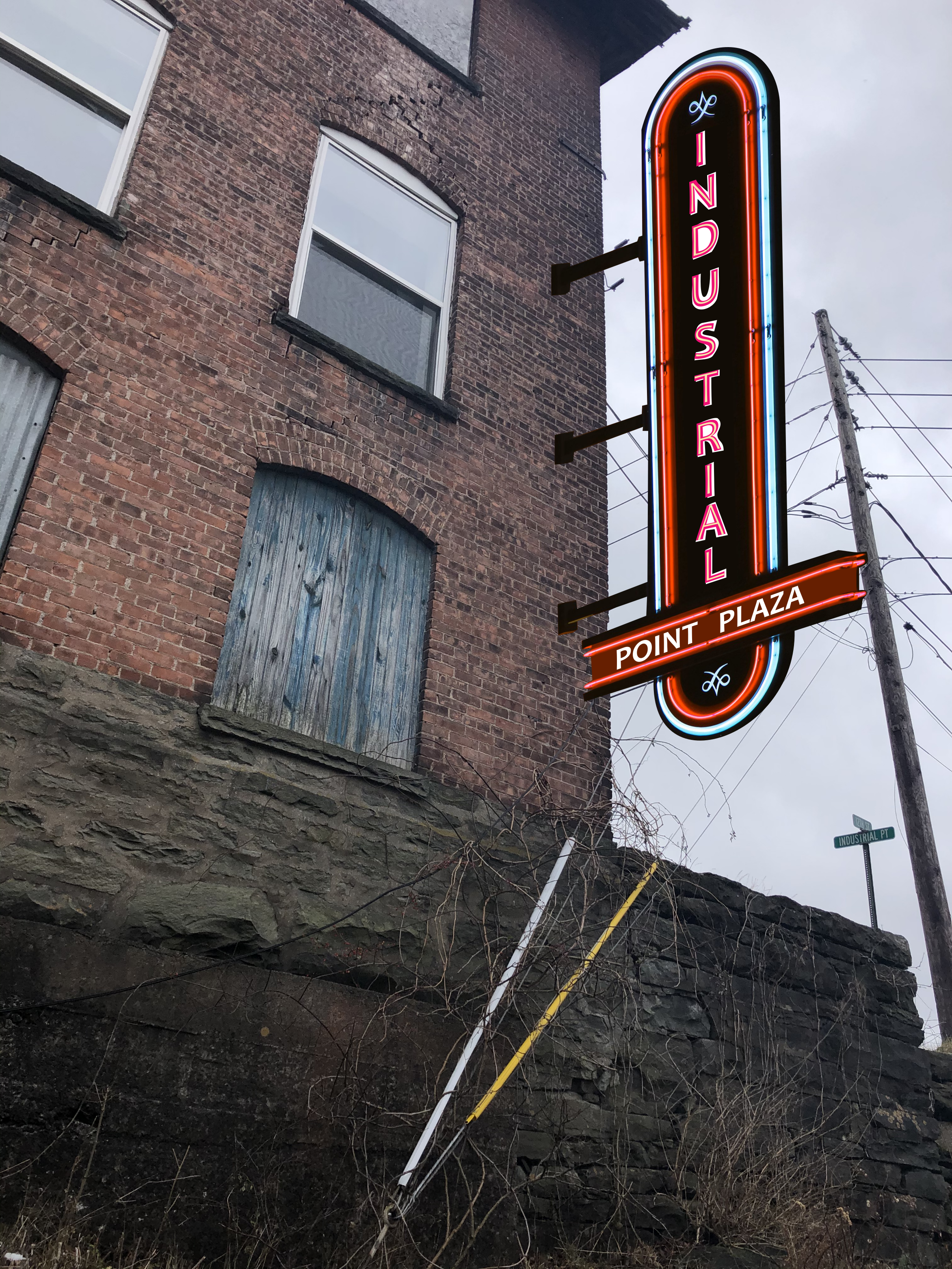
Let’s explore an imagined landscape out of our existing one. This rendering features separated sidewalks clipped from somewhere else and placed alongside Grandview Avenue (Route 6), between downtown Honesdale and the former K-Mart’s commercial corridor. Bonus buildings were added to make this imaginary walk more enjoyable.

This road was designed in service of car/truck flow yet, connected to it are countless places people visit regularly as patrons, residents, and workers. As such, people walk along this stretch of road every day, even though it’s neither comfortable nor convenient to do so.

Those who walk this way didn’t design the road to make their trip to work more terrifying. Their core usage was not accounted for. We can plan around more thoughtful accounting going forward. Sharing, talking, and thinking about images like this can help.

Visualizing changes to our neighborhoods is a productive practice. The perpetual flow of people and places is a truth we share. Change is constant and stasis doesn’t exist. Discussing, imagining, and planning around changes before they inevitably occur can also be empowering. Especially when we invite engagement and welcome participation of all stakeholders.

At times, the built features we know seem like fixed landmarks. We have longstanding associations with spaces we know. Everything can make up the tapestry of what we call home. These physical landmarks aren’t static, however. They didn’t always exist the way they are now and they won’t stay in their current state forever. That’s what the rendering above and the next one below are all about.

Presently, with a road fully built out in service of tractor trailer turning radii and a certain throughput of vehicle miles traveled, pedestrians pushing strollers have no choice but to cross a raucous highway to pick up groceries. This visualization features a walking bridge above 4th Street (Route 6/PA 191), near the CVS. Said bridge was clipped from elsewhere and placed atop a busy intersection.

Walking across this road is currently hectic. Poles and signs obstruct views. Walkers have to push buttons (something unimaginable for someone driving) to have their existence recognized. Drivers have been known to honk and yell at people crossing the street. People who are simply trying to go by toothpaste, in precarious, mid-crossing positions planned for by others who never walk nearby are stuck in unaccounted for limbo.

Again, those who walk here didn’t design the road to make their family errands more life-threatening. Their core usage was not accounted for. Going forward, it can be. In service of balanced street books, we can cook up solutions to existing road problems ahead of time.

There are many ways to address this but, in a decade’s absence of accommodation, imagining a more fantastic option (new bridge) seemed appropriate. It’s shown as a reminder that our landscape is not fixed, that we can design around accessibility for all road users, and that vast amounts of public funds are spent on safe automobile spaces, without hesitation, every year.

An additional bonus here is a commercial sign turned way-finding trail signage shown as another reminder. The CVS developers were good neighbors back in 2010 and agreed to reserving space for river access. People use this access and, someday, we can pursue enhancing it, thanks to a dozen-years-old planning process that discussed more than the bare bones basics of expediting drive through commercial development downtown.

Considering even a little bit more now can make a big difference way later. Re-imagining the landscape is an important step in that process. So is knowing that we can design around re-imagined landscapes and are not limited to already existing patterns.

Alternative ideas come to life all the time. That’s why communities pursue comprehensive planning and feasibility studies. Recently, the Downtown Honesdale Revitalization Plan (2021) did this very thing by showing how our streetscapes could look different in the future. Similarly, the Wayne County Trails Feasibility Study (2020) did this as well by highlighting how practicably feasible and publicly popular developing a Lackawaxen River Trails network between Honesdale and Hawley could be.

Combined, the Trail Study’s identified core trail along Main Street in Honesdale wonderfully aligns with the Revitalization Plan’s supported streetscape priorities. In the same way that a more walkable community connects with many other things, thoughtful planning can turn two projects into one.

Main Street Sidewalk and Lackawaxen River Trail, 600 Block Honesdale, West

These planning processes are within our collective abilities to engage in. Grant funding and consultants help us identify shared goals. Everyday people sharing time and resources can do the same. Engaging in such ideation is the important thing. That’s what starts and continues conversations.

We can take a picture of a place and draw things on top of it. We can write about our neighborhood experiences and how they might be made better. We can share those stories with our friends, family, and elected officials. We can use free tools like Google Maps, the Snipping Tool, and Inkscape to cut out pieces of other places and lay them over our home places to tease out potential realities.

Work is constantly being done to plan for the future. Everyone can join in, in their own way. The more we share this work, the more we can be a part of everything already happening all around us. The larger and more diverse that body of participants is, the more thoughtful and varied our solutions will be.

Welcome to the party. You’re invitation doesn’t expire. Streets are for people so come on out to play.

Leadership Stylings

Honesdale Borough Council recently made a statement (found HERE) at their May 3 meeting describing the Borough’s side of a code enforcement story that affected a local business (Black & Brass Coffee Roasting Company.) Black & Brass’s side of the story is partially told HERE. We need not rehash that tale yet don’t mind taking a moment to unpack a bit of how it was told.

Without getting into the regulatory weeds we so often enjoy hiking through, there are a few items worth noting about leadership in this saga. Black & Brass, having reached a moment all too familiar and perpetually unfortunate, found themselves with a single path forward. A path, prescribed by the Borough, that required hearing fees, time, and potential legal action to find resolution.

Few have the resources to counter municipal machinery when it decides to chug along, directly atop your existence. Black & Brass decided to find another way to address this challenge. One that didn’t involve a lawsuit that costs everyone money better spent on food.

Borough Council didn’t provide many options so Black & Brass created their own. That’s what community leaders do. They create things.

The above (and soon to be) below-referenced statement from Honesdale Borough Council highlights their recent leadership style. A style less about creating things than it is about insisting on the impossible; things staying the same.

It’s worth noting that Council is made up of many people and many ideas. The collective body carries with it the weight of local authority, however. That weight is pushed around with the momentum and oft-unchallenged power of a singular entity that enforces rules for how to live instead of facilitating progress that makes it easier to live here. Honesdale Borough Council, as a singular entity, is what we’re looking to better understand.

  1. In Council’s statement, it was indicated that “… the Borough was contacted on at least two occasions by the Pennsylvania Department of Environmental Protection (DEP) regarding air quality complaints… ” and that “Upon it’s investigation, the Borough Zoning Department notified Black and Brass that it was alleged to be in violation of the Borough’s Zoning Ordinance due to its roasting operation at both of its locations.”

    >> This implies that the DEP’s investigation of air quality complaints led to Borough action. It turns out, the DEP was simply notifying the Borough of complaints they received and determined to be a neighborly nuisance that didn’t warrant their further involvement. The Borough’s actions were their own and based on the Borough’s interpretation of their zoning and property maintenance/quality of life ordinances (chapters 210 and 160, respectively, of the Honesdale Borough Code.)

  2. In Council’s statement, it was indicated that “Honesdale Borough Council has not taken any action against Black and Brass or its two landlords. The only action to date has evolved from the zoning office which is charged with administration and enforcement of the Zoning Ordinance and Quality of Life ordinance.”

    >> This implies that the Borough is not responsible for their own ordinances or administration thereof. Honesdale Borough Council is responsible for and has approved the adoption of and amendments to both the Honesdale zoning ordinance and quality of life ordinance. That authority rests solely with Council. Further, the zoning office and officers tasked with day to day administration and enforcement of these ordinances are authorized and hired to do that work on behalf of the Borough, by Borough Council.

  3. In Council’s statement, it was indicated that “The ultimate interpretation of these ordinances is left to the Zoning Hearing Board, and if necessary, to the courts.”

    >> This is true in the sense of adjudicating the applicability of or disputes related to zoning related issues. The implication, however, is once again that Borough Council itself is not responsible for any of this ongoing conversation. This isn’t true because it is Borough Council’s responsibility to approve and adopt ordinances or amendments thereto. What’s more and as indicated above with respect to the zoning office/officers, members of the Honesdale Zoning Hearing Board are appointed by Borough Council to serve the interests of the Borough.

  4. In Council’s statement, it was indicated that people expressing support for Black and Brass are “… incorrect to blame Honesdale Borough for the recent relocation of the Main Street roasting operation and the projected relocation of the Willow Avenue operation.”

    >> We can’t help but disagree. What might you do if your previously permitted business were served a cease and desist order carrying the enforcement weight of a municipal government?

Honesdale Borough Council is responsible for the existence, administration, and enforcement of all Honesdale Borough ordinances. If those ordinances include language restrictive to gardening because compost could be defined as garbage or if those ordinances don’t allow upper floor apartments or coffee roastery cafes to exist within walking distance of each other, then Council has the authority to change those ordinances. Likewise, if code enforcement officials are interpreting equal intensity smells to be more offensive for one business than another, then Council can redirect the efforts of that code enforcement official.

Deferring responsibility is not productive when trying to solve community challenges. Borough Council’s rules and how they manage them matter to all of us. When Council insists they are not responsible for the enforcement of rules they’ve signed into local law, they’re setting an example we hope future leaders do not follow.

Save the Brick

Sometime after September, 1903 but before or in March, 1912 a large brick building was born alongside where the West Branch Lackawaxen River confluences with Dyberry Creek. This has been an industrial area since the hemlock swamps of Lenape lands were drained by colonial, urbanists in the early 19th century.

Sanborn Map Company, September, 1903 (left) and March, 1912 (right), with Building Highlight

Sanborn Map Company, September, 1903 (left) and March, 1912 (right), with Building Highlight

The last remnant of this town-as-we’ve-know-it heritage is numbered 311 off 12th Street. It’s depicted below in a recent photo (right) and with an alternative vision (left). This stately, near 2,700 ft², multi-story structure has sat largely vacant and unused for a decade; having been condemned after a 2010 earthquake. Some have suggested tearing it down. We and others suggest fixing it back up.

Land use issues play a critical role in how our environment gets shaped. Understanding these machinations is vital for general assessment, without which we can’t clearly advocate for helpful community development. It’s easy to take existing buildings, businesses, sidewalks, and parks for granted as fixed elements within the local landscape. Because maintaining what we have is plenty of work, we might forget that a set of rules and norms led to the creation of present day features however long ago. We might also forget that these elements can be re-imagined or created anew.

Our mix of businesses, housing, trails, and parking was shaped by land use policy. We can see this playing out in real time today. Norms requiring off-street parking make upper-floor housing difficult to develop, even when a noted need for housing exists. Rules suggesting transforming agricultural products into drinks for on-site, retail consumption is manufacturing make it problematic for those in the beer or coffee business to maintain their neighborhood-enhancing businesses.

These issues are presented as black and white, printed on sacred ordinance paper, and something we have limited agency over. Our officials, however, choose to create and continue these rules and norms. We, as the locally represented collective, allow our representatives to perpetuate the same.

The notion of private property is worth assessing in a similar light. We provide a lot of leeway for what’s done within the deeded boundary of a neighbor’s parcel. This is helpful for expressing personal freedoms and allowing for organic evolution of place but what about vacancies or under utilized spaces? Where is the good neighbor line between letting something useful fall down or be torn to the ground and encouraging an alternative? Is the line more clearly demarcated when alternatives could achieve a noted, goal-advancing, community good?

We’ve accepted the concept of “anything goes within those walls because what happens across that imaginary line is none of my business” as a norm. This black and white precept was defined by us and didn’t always exist in the same way.

Should we hold fast to an idea that’d allow for the demolition of something that could be productively reused? Do these notions change when a given something is “owned” by a public entity?

Site Map, Atop 2019 Aerial Photography from the United States Department of Agriculture

Site Map, Atop 2019 Aerial Photography from the United States Department of Agriculture

This warehouse of interest is currently owned Wayne Memorial Hospital, a non-profit, community-controlled entity we’re all glad to have in town. It’s surrounded by natural water features and Borough/County-owned lands, with shading provided by the landmark shadow of Irving Cliff. The neighborhood is undergoing a redevelopment into park and river access that’s part of a grander network of trails and public lands planned to better connect downtown Honesdale all the way to Hawley. High value, transformational potential is available here in bounds.

Years of sidewalk chats imply this building is unsavable and that the aforementioned earthquake damaged the structural integrity beyond repair. Our understanding is a bit different. You can view the structural reports for 311 Twelfth Street we recently acquired HERE. Condemnation aside, the building has stood strong since that decade-ago earthquake. Further, these reports identify the same foundational issues five years earlier so this strong-standing is even more long-running.

Admittedly, there are numerous concerns to address here, like diverting water from the site, replacing half of an exterior wall, redoing sub-level, structural beams, and likely re-securing the superstructure to a new, pier-based foundation that removes weight from the existing basement slab. Remediation may include even more work than that and it would all be costly but solutions do exist (albeit rarely discussed) and are itemized in the engineering reports (linked above).

Paying for these repairs may very well be outside the scope of the current property steward or another that’s on deck. Community organizations that operate in a not-for-profit environment have a whole suite of value judgements to make and targeted goals to pursue. We wouldn’t expect every entity to save this building. What’s vital, however, is a fuller cost accounting. Some entity may be interested, if given the opportunity. Demolition is a choice, not a forgone conclusion.

The marketplace of ideas is bigger than a single stakeholder’s interests. Investment limits of one group may be the starting point of another. This building is, by all accounts, huge. It’s very difficult to build something this large from scratch so its very existence represents an existing, leverageable investment.

Structure of Interest, December, 2020

Structure of Interest, December, 2020

With a non-profit or governmental property steward, wouldn’t it be fair to expand the use/reuse discussion among the community at large? When identified community goals require space, shouldn’t we save suitable spaces?

  • We need housing. How many small, affordable units could be retrofitted into this space?

  • We’ve seen a development trend embracing the value of mixed use. How many uses could be built into this structure?

  • We know there’s adjacent public land. How economical would it be for people to live, work, and play nearby?

  • We’ve learned the value of open spaces by spending a year without close proximity. How valuable would it be to have a large space for festivals and events we’ve recently missed so dearly?

  • We understand the lack-of-taxable-property issue in a borough filled with governmental, institutional, religious, and other non-profit buildings and we regularly see the necessity to invest in public infrastructure like stormwater. How helpful would it be to increase our tax base by putting this building back on the roles?

We, our neighbors, and those before us manifest the neighborhood. A natural law doesn’t define a parking requirement or a demolition order. Human decisions do. None of that is fixed. Perceived truths or laws like these are really just the organizational flow of information among structures we design. When we know that, we can lobby our local representatives for change or make changes ourselves.

Expanding the narrative beyond demolishing something that contains a prescribed, engineer’s recipe to fix is one way to embrace this fluidity and have a more productive discussion. It’s okay to consider different structures and other voices in a conversation about preserving community assets. In fact, when the property steward in question is an organization or government entity that represents the people and when these stewards pay less than their neighbors on otherwise taxable improvements, then their demolition plans should not be promoted in a vacuum.

Recent examples aren’t our only guide. Buildings don’t just have to come down. We can build anew and we can lead by new example when fully using, rehabilitating, and re-purposing what we’ve already got. That’s what we’d submit should be done here.

If the current or the next deed holder of this building is constrained by demolition plans, then a compassionate task would be to for that entity to embody a grantor mindset and at least look for a less-constrained grantee. Sometimes the most appropriate thing to do is transfer a gift to others who can pay it forward.

Parking Downtown

“Don’t is always seem to go. That you don’t know what you’ve got til it’s gone.”

Jonie Mitchell

We agree with Jonie. It’s worth considering options before we go and pave paradise.

Some say there’s a parking problem caused when trying to reactivate upper floor housing on Main Street. We’d suggest that any perceived or actual need for parking is a symptom. Misdirected land use policy, a lack of creativity, and the gift of historic building stock are the causal factors.

Regulations requiring off-street parking in downtown neighborhoods for the more complete and mixed usage of existing structures is a misdirection. Insisting that more parking is the only way to reactivate vacant spaces isn’t creative. Holding valuable, historic buildings back from expressing their fullest, community contributions squanders a gift.

The core issue of filling in our Main Street corridor isn’t a parking one. It’s a matter of using what we have more fully. Revitalization should be focused on building capacity within existing structures and spaces. New construction more naturally comes second, where it’s encouraged by the organic expression of ecosystem growth.

If we flip our considerations toward using what we have, then parking, rightly, becomes secondary. The challenge to overcome is a straightforward gap in potential and opportunity. Upper floors can potentially be refilled with activity, energy, and uses but the opportunity to refill them is directly limited by regulations and the administration thereof.

Existing Parking where Buildings Once Stood - November, 2020 - Not a Reason People Live in or Visit Places

Existing Parking where Buildings Once Stood - November, 2020 - Not a Reason People Live in or Visit Places

A lack of parking isn’t preventing the vertical revitalization of Honesdale. But, because project approval often demands it, insistence on providing parking is. If we reevaluate what we insist on, we address the issue. The limitations are not physical, they’re regulatory.

Tweaking our zoning ordinance and changing how we administer it opens all sorts of upstairs doors. It’s a direct fix and a simple solution that favors progress. An early focus on parking creates a false narrative that implies parking is a necessary building block of town life.

Parking is useful but it’s not necessary. Why? Because people don’t use automobiles everywhere within a town. They also walk and ride around without cars. Take a peek. It’s happening right now.

Another direct way to make a town more livable is to make it more walkable and therefore reduce the need to drive, which in turn reduces the need to park. There are numerous ways to accomplish this aim but, again, adding new downtown parking isn’t one of them.

Building a new parking garage is an indirect way to revitalize higher-up spaces. Using our existing parking more fully is a step toward direct action. Changing our regulations to simply allow for the redevelopment of existing buildings without unnecessary restrictions would yield immediate results. Re-imagining our spaces as places to live in that aren’t dependent on automobile use is something worth planning around.

Planning exclusively around parking is misguided, unless the thing you’re trying to create is parking or the opportunity for more people to drive around our otherwise walkable neighborhoods.

Parking spaces are practically useful. That’s easy enough to concede. However, from a value per unit of area perspective, they’re near the least productive use of space we’ve got, particularly in our downtowns.

Whether you’re using the metric of assessed value per acre or that of use potential, parking offers very little return on investment. This is because it’s typically designed around a single, non-human use and it often has no built improvements, aside from pavement.

When considering the inherent investment of infrastructure, utilities, cultural capital, and everything else already in place along our main streets, it’s worth creating, maintaining, and encouraging a maximum mix of uses. Choosing to build stand-alone parking is a misallocation of shared resources.

You wouldn’t build a quarry in the middle of productive farmland. You shouldn’t build a shopping-only center away from where people live. Building parking downtown, without a mixed-use component, feels like a similar misuse of space.

The suggestion that “solving” our parking “problem” demands building expensive, single-use garages represents a focus on a disconnected symptom. Promoting new parking as being of paramount importance disrespects less-car or car-less living arrangements. Such arrangements are desired and useful in livable places and for neighborhood resiliency.

When we plan, we guide development toward the image of our plans. Residential living without an automobile is worth designing around. Our planning constructs should treat people as principle users and automobiles as accessory. That’s one way to make a place easy to live in. The opposite approach applied to our village centers does not sound like revitalization.

To imply the only pathway toward more downtown housing is by first building parking is disingenuous and glosses over the fact that we can more cheaply address root causes by simply changing our zoning. Principally permitting upper-floor residential and mixed-uses downtown and removing off-street parking requirements for the redevelopment of existing buildings are turn key solutions. And, they’re equitable.

If parking is really everyone’s problem, which we’d argue as untrue, then holding building use hostage for parking ransom is a policy disproportionately disadvantaging the very buildings and building stewards we rely on most; namely, Main Street structures that partially belong to everybody who patronizes local businesses, works in the same, lives nearby, or drives through town.

The structural bracing for the character we cherish and the existence we desire to revitalize is our building stock. That framework is less able to be cherished and revitalized when its use becomes dependent on parking. We need to change our collective minds about this.

Existing Sidewalks that have Always Been There - November, 2020 - One Reason People Live in or Visit Places

Existing Sidewalks that have Always Been There - November, 2020 - One Reason People Live in or Visit Places

In recent history, more buildings have come down in our downtown than have gone up. Are we leading by example for a better future if the next buildings that grow up are parking garages? If we champion low value construction in our downtown, does that tell a story of progress? Are we realizing local opportunity by celebrating structures that will at best simply store cars and at worst often sit empty?

A revitalization focus on parking feels like a design intent on making Honesdale more desirable to visitors looking in from the outside than a design intent on making Honesdale easier to live in while already here. We can do better than that.

Parking development isn’t a zero sum game when it comes to downtown life. It’s not one thing or another. And if it were, we’d submit that allowing the maximum use of existing buildings should come first. It’s cheaper and easier and, logistically, that’d give us a better sense of how much parking we actually need.

More thoughtfully, that’d allow the natural progression of our downtown ecosystem back into the productive, mixed-use environment it desires to be. A state it was once in, before our thought leaders and policy makers got blinded by the head lights of car culture.

Assessed Parking

“When new (uses are) added to older (ones), the addition often cuts ruthlessly across categories… And wherever it is forced to stay within prearranged categories… the process… can occur little if at all.”

Jane Jacobs “The Economy of Cities”

Above, Jane is speaking about work being created within a city but it’s equally applicable to land use creation. These notes were what she saw as the inherent nature of livable places evolving over time, increment by increment. If accepted, seeing this happen would be a sign of an active economy and, by most accounts, a positive development.

What if, however, we noticed these same data points and saw them as concerns to decline acceptance of or as helpful trends to stop in their tracks? Wouldn’t that be counter productive to natural community growth? Let’s look at one Pennsylvania municipality and see what they choose to do when such evidence was presented.

Honesdale Borough Council recently denied a conditional use application for a Main Street building. The plan was to reactivate and redevelop some upper floors for residential use. The following is a critique of Council’s decision and others like it. First, a little background.

The Honesdale Borough Zoning Ordinance (§210-19 F.) states “Any structure or building hereafter erected, converted, or enlarged for any of the following uses, except uses in the C-1 District, or any open area hereafter used for commercial purposes or manufacturing purposes, shall be required to provide not less than the minimum number of parking spaces, as set forth… .”

Underlined emphasis was added above because the main decision we disagree with involves an existing building that’s within the C-1 district and therefore not typically required to provide parking. This zoning district represents the commercial corridor of downtown Honesdale that surrounds Main Street.

The project in question involved a building at least as old as 1885, as seen in the Sanborn Map from that year (below). Like all others of the vintage, this building has gone through many changes over time but has multi-use roots, since that’s the most productive way to utilize structures in compact, urban neighborhoods. This building is also safely within the C-1 zoning district, mentioned above as a place where off street parking is (rightly, in our view) not required.

Sanborn 1885.png

The issue, though, is the 3rd floor is currently unoccupied and the 2nd floor was recently under utilized. In order to make upper floor renovations and changes in use to accommodate additional residential units, the project must pass conditional use hurdles placed in its path by Honesdale Borough Council.

Rephrased, to make reasonable changes to an existing structure, in an area where the highest intensity and most mixed land uses fit best due to infrastructure access and connectivity, the building steward has to overcome extra administrative challenges and added investment costs.

Now, let’s consider the issue of parking. Parking, in fact, is the issue at issue with this proposed development. As an affront to the already referenced zoning language, the conditions placed on this building rehabilitation project are that of requiring off street parking. Due to the age and nature of the block, this building has no room for the “required” off street parking within the confines of its parent tax parcel.

As with most downtown lots, the parcel lines approximately follow the building footprint. The historical development limits of a traditional neighborhood often leave no room for on site parking. Leaving aside the actual parking burden and need for the same, parking was proposed for this redevelopment project on a nearby lot.

This type of concession is common. Prearranged parking resources on lots other than the building lot in question are allowed as proposed alternatives to on site parking. In fact, a similar development proposal was recently approved with this same type of arrangement.

The map below shows these projects in relation to each other. Building A is where the project we’ve been talking about was proposed and where conditional approval was denied. Building B was where a similar project was proposed. The conditional approval in that case was approved.

Conditional Use Comparison.png

In a straight line, Building A was approximately 607 feet from the proposed parking. By walking on the street grid’s sidewalks, the distance is approximately 1,138 feet. This arrangement was denied in April, 2020.

Building B was approximately 667 feet in a straight line away from its proposed parking and approximately 957 feet away away, by foot travel. This arrangement was approved in June, 2019.

What makes one project worthy of approval and the other not? It’s tough to say but it’s not relative distance from proposed parking since those details are similar. It’s also not use type that’s causing problems.

Building A was declined the opportunity to add resident apartment stock to a lively downtown facing housing limitations. Building B was approved the opportunity to add vacation rental stock.

In our view, both of these development projects should have been approved, without additional conditions requiring off street parking. Additionally, when previously allowed for solutions (like dedicated, neighboring parking) are accepted as suitable for one development and not another, we do not have an equitable administration of local regulations.

While we don’t agree with Honesdale’s Zoning Ordinance, with respect to its unnecessarily restrictive parking requirements and its inability to welcome mixed use development in places where that type of development has a longstanding historical precedent, we do expect equity in how ordinances are administered.

If two local stakeholders present equivalent projects and one is approved, the other should be too. That’s just basic fairness.

Residential Honesdale, April, 2020

Residential Honesdale, April, 2020

The Central Wayne Regional Comprehensive Plan (2010) has a stated goal to “Provide for a diversity of housing opportunities for the economic and demographic groups within the Region, in harmony with existing development and the historical and natural environments and in a manner that allows existing and potential residents of the region to live in the region throughout the life cycle.

The Wayne County Comprehensive Plan (2010) has a stated objective to “Work with municipalities to ensure land use regulations do not unnecessarily limit the ability of the private market to produce affordable housing and condensed and mixed use projects that match traditional, small town development patterns and accommodate the varied housing types now found throughout the County.

Denying an existing building’s ability to re-add mixed use residential in a walkable, core downtown area is an action against these stated planning aims.

Charles Marohn of the Strong Towns organization suggests that incremental intensity of uses should be allowed by right in every zoning district. We can’t help but fully agree. The natural evolution of a place is illustrated by these very types of development and investment and it’s best practice to let these changes happen.

Seeing this progress in motion should be a positive trend to take note of. We would argue these changes should be celebrated and encouraged by local governing bodies. At the very least, we shouldn’t be actively getting in the way of more people more fully utilizing our central neighborhoods.

Downtowns are where our value is concentrated. If we can’t express and leverage that value in positive ways, we’re not maximizing our shared investment in common infrastructure and culture.

The chart below highlights this metric by looking at the assessed value of different building lots in Honesdale. Two are within the downtown core and involve existing buildings that recently proposed redevelopment. Two are on the fringes and represent entirely new development in the image of highway commercial patterns.

Assessed Value Per Acre

The difference in assessed value is striking when considering the parent parcel size, atop which the buildings in question rest. Each of these projects involved a conditional use hearing. All were approved but one.

If you looked at the numbers and the neighborhood, you’d never guess the truth. That being, Honesdale Borough placed administrative hurdles in front of and scuttled a mixed use project in a building on Main Street that’s been sitting there since we had a canal.

We’d recommend downtown building stewards and everyday people challenge decisions like these (by proposing mixed use redevelopment of existing buildings over and over and over again) and the notions they imply as often possible. Drop us a line if you need a public meeting advocate. Municipal government does not have to add restrictive conditions and deny reasonable development based on the same. It’s their choice.

If government officials want parking at the expense of building vitality, perhaps they should work toward building more parking or walking infrastructure because what we’re seeing instead is akin to a select demolition plan that clears lots of usable building stock.

Some downtown revitalization efforts have recently begun and will lead to an eventual plan. This topic and others surrounding it will inevitably come up. Planning consultants and public committees on design should also counter the logic of weighting off site parking higher than the continued use of existing Main Street buildings.

Downtown Honesdale, January, 2020

Downtown Honesdale, January, 2020

Many of downtown Honesdale’s buildings aren’t being used to their fullest capacity and these historic buildings will never see full productivity if they need to provide two parking spaces for each proposed dwelling unit. Heck, here, providing for those spaces wasn’t even enough. We need to think differently about this arrangement.

We could reevaluate those parking space requirements or we could make upper floor, residential a principally permitted use in commercial zoning districts, or we could simply step aside and choose not to add unreasonable conditions that hold us all back.

In this case, the commitment isn’t too much to ask. We just need to acknowledge that some our older rules are unfit for the present day and that our administration of those rules is a roadblock that doesn’t have to be there. More plainly, we can make progress on this front by simply getting out of reality’s way.

Jacobs, again in “The Economy of Cities,” says our central places act as the “primary organs of cultural development.” If we want these places to stay that way, we should express strong criticism against municipal actions that thwart natural progress and, instead, begin to embrace this same progress that’s happening in full public view.

We should listen more closely to the humming of our local landscape. It’s alive and moving, no matter what we write in code books. We’d vote to let our downtown neighborhoods live.

Public Discourse

A few old time buddies meet for coffee and doughnuts to chat local politics. A pair of filmmakers toast bar beers over neighborhood tales. A crew of highschoolers spray paint a lesser-used bridge abutment with profanity. A family talks about their day over dinner.

Does this list include a pattern break or conversational continuity?

Public facing surfaces covered with unauthorized images and messaging have many names; Graffiti, vandalism, gorilla art, advertising, murals, etc. Most of those tags are saddled with stigmas and the ones that aren't usually stipulate a creation presented under certain conditions. All, however, are part of a neighborhood's culture and represent pieces of an active conversation.

What community places are yours enough for comfortable self expression?

Abutment Message Board, South Entrance, February, 2020

Abutment Message Board, South Entrance, February, 2020

Some of us like morning coffee. Others prefer evening beers. Some of us enjoy late night shadows. Others favor dining room light. Communicating within each frame carries social obligations and requires investments of participation, an exchange of resources, dedicated places, and groups of people choosing to spend time together.

Not everyone likes coffee or is old enough to legally drink or goes outside at night or regularly eats with their family, however. The collective shares enough for kinship but is made up of differences. Each needs their own share of shared space.

The old railroad bridge abutment turned tunnel near Honesdale’s Park Street Complex is one of those spaces. Every year, it fills up with conversational remnants, gets reset with a blank slate of fresh paint, and then the pattern repeats. The cycle is a beautiful sight to behold. Like a bivalve village’s lung, filtering our thoughts and exhaling deep local¹ signage.

Sure, bits of the conversation include problematic and grotesque messaging that, on average, isn’t kid friendly and, in some cases, isn’t particularly comforting to see but within the chaos you’ll find instances of reflective self policing. Vulgar, counter-notations sprayed atop gang references and hearts shoehorned in among hateful visuals are both part of an ongoing narrative.

In a general sense, the discourse can be encouraging, even when elements of the dialogue are discouraging. Layer by layer, there exist examples of community course correction. It’s like a remixed town hall meeting. Ideas are shared and considered and an evolution of understanding evolves in public view.

Abutment Message Board, West Side, December, 2019

Abutment Message Board, West Side, December, 2019

Abutment Message Board, East Side, December, 2019

Abutment Message Board, East Side, December, 2019

Room for opinion diversity means people feeling free to share what's important to them. Opinions aren’t held by all and some should be immediately challenged but space within which to freely express opinions is vital for every community.

Part of the East abutment image above features the statement “F*ck This Town.” That’s a simplistic notion devoid of constructive feedback but somebody wanted to say it so it’s worth knowing it exists.

Might it be just as important to have a high profile, town-celebrating mural at a prominent intersection as it is to have a town-deriding message, shared with a limited audience under a bridge?

Both carry notes of truth to be aware of as community members in common and represent concepts expressed on both ends of a spectrum. We can balance out the messaging by favoring positively lit stories through increased scale, support, reach, and fanfare so it seems entirely fair to have a few platforms reserved for everything else.

More room can be made for sentiments that build things up instead of those that tear things down² but it’s probably healthier for the full breadth of our ideascape to exist than for that existence to be stifled with regulated favoritism of one delivery form over another. Topics like permission, vulgarity, and misdemeanor tend to lead the way when someone draws a penis on a wall but enforcement from the top doesn't stop stories from bubbling up near the bottom.

Isn’t there value in knowing the scope of perspective of neighbors in the neighborhood?

Democracy includes people using their voice. Sometimes that means we hear inappropriate or profane things. We can't know what someone has to say until they say it and we can't control all channels in which something can be said. What we can do is consider what's presented to us, decide what we like best, and, as necessary, offer alternatives in reply.

When we see a gorilla offering of words and pictures, we could see an illegal act of norm defiance or we could see an illustration of neighbors staking their claim in the neighborhood by picking a place and sharing ideas. And when a commemoration of a harsh drug gets painted over by another toasting an objectively less harsh one, there’s view of comparative truthes in action. A wall-unfolding debate is not unlike countering points of view in newspaper editorials. Both are open discussions, they’re just happening across different media.

Community conversations are constantly breathing all around us. Staying informed means keeping our ears peeled, irrespective of the source. Letters to the editor, public meeting comment, and wall scrawls are all kinda the same thing. We’re trying to read as much local writing as possible and recommend tunnel strolls when en route to the Stourbridge Project.

Abutment Message Board, Dirty Footprints Restarting the Discussion Cycle, February, 2020

Abutment Message Board, Dirty Footprints Restarting the Discussion Cycle, February, 2020

Continual Maintenance

Honesdale’s building stock is imbued with past energies. We’re lucky in that way. Much that once was remains on full display, standing like inspirational guideposts within the local landscape. These markers, be they smooth sidewalk stones, ornate home porches, or waning industry outposts share space through time and connect us to multi-generational neighborhoods.

Stewardship of these resources is an active and ongoing process. As extensions of us, our buildings can be equally alive but we must provide life to keep them upright. Older structures can still share value, like the basic shelter and useful space inherent in their form/design. They’re already here and a lot went into their formation so it’s worthwhile and economical to keep them intact.

Everything that went into a space’s creation and everything created within it is a gift. It played host to the past, sits in the present, and remains useful as remix fuel to efficiently support future endeavors. These are existing resources, native to our neighborhoods but utilizing them to their fullest takes a payment of tribute. A small offering of maintenance and use. That’s the responsibility of a building steward and it’s a fair exchange for what’s been given to us.

This is a relationship. Without respectful balance, there can be instability. Something falling or burning or being torn down is a symptom, not singularly caused by accidental or intentional acts, however. One generation unaccounted for could be enough. Roofs caving in, water damage, and errant sparks can all lead to demolition. Vigilance is needed in prevention but less the reactionary kind that imposes stricter control and a blame of confrontational street art. Community assessment that allows for continual conversations is more proactively diligent.

Discussion of questions like…

  • Why have certain buildings remained unoccupied for decades?

  • Where do our neighbors without homes find places to sleep?

  • How does something from the 1940s get neglected then re-imagined as a hub for vibrant graffiti?

  • Was a secret, forested amphitheater-meadow at dead-ended Olive Street more productively alive with someone camping there than it was when the last business closed?

  • What happens when a space attracts the “unauthorized” hang-out attention of our next generation?

  • Can a place be more fruitfully used, via choice over obligation, by “trespassing vandals” than by nobody, as an otherwise abandoned shell?

  • Might a place lead a more beneficial existence in an “unofficial” capacity, alternative to the example set by a previous, “official” utilization?

… are parts of conversations we like having on a regular basis.

What we create within the community is part of a continuum. It’s not only easier to utilize what we’ve got before building completely anew; it’s more respectful of local character and heritage. With a universe of opportunity in every project, we’re not limiting our creative options when we maximize the use of existing resources.

Why not re-activate under-utilized nooks hidden in plain sight before building something fresh? Why not keep old buildings you can already see the blue sky through alive by developing pathways for them to be sold or gifted away, instead of waiting until they become a pile of debris deeded to somebody with other priorities? Is there room to question what it means to own portions of our landscape and regularly remind each other how important it is to provide care for the same?

What other buildings that currently exist would we miss if they were no longer around? If they’re valuable to us beyond surveyed fence lines and outside what is legally “ours” and “theirs”, are they not part of our shared existence? Would we challenge our notions of what healthy and resilient neighborhoods look like if it meant more brick gets left standing? Or are we, as Peter Hall wonders, “… saddled with the previous generation’s value judgments… ?” We’re open to questioning these things and questioning ourselves in the process.

One way to see preposterous public drawings and phrases is as vandalism. Another, is as under-valued pockets of opportunity being highlighted and potential being realized. Narrowly scanning the horizon for the next batch of spray-painted peeni (or penises) and reporting skateboarding movements to a neighborhood watch feels like focusing on a single, back building wall, while blinding ourselves to the rest of town. We think there are more holistic concerns than the crimes investigated in American Vandal.

There can be cycles of death and rebirth in an approximately 75-year, structural life. After decades of vacancy, what appears to be a disrespectful paint job may in fact be the opposite; the acceptance of a gifted guidepost as a place worth being in again. Cherishing a beautiful space can come in many forms. Rediscovering potential beneath decay is celebrated when it’s more thoroughly understood. Is a vacant building getting tagged worse than that same building staying unnoticed and eventually crumbling? Perhaps new color additions are natural signs of a living community and neighborhood reclamation.

Olive Street, End Meadow - April, 2013

Olive Street, End Meadow - April, 2013

Another New Year

Thanks to everyone who attended and followed along with the NYE Ball and Dance Party we put on with Black & Brass at 6th & River.

Events like this aren’t just for everybody, they are everybody’s. What’s created is what engaged participants make of it. Any given project we work on is a single piece of a grander inspiration cycle, featuring connection points to shared space and time, meant to be experienced, then carried forward as personally or collectively desired.

Specifically, this dance party and ball was designed to be enjoyed in whatever ways we cho(o)se. It was a happening that incinerated in the moment, leaving dust we all danced ourselves clean of before heading back home to a new year. As always, some sparks remain, to be ushered on down the line of inspiration cycles to come. What’s next for all of us?

May the creative boundaries between producers and consumers continue to morph and contract in 2019. The greater canvas of the local landscape is vast and filled with abundance. Events and projects like this one are as much yours as ours. That’s just the way we like it in festivaltown, Honesdale. Happy New Year.

New Year’s Eve bar by Here & Now and grooves by DJ Jus’ Boogie.

Spatial design lead: Lisa the Maker.

Party photos above and below by Jack Kingston.